Monday, September 20, 2010

Ancient Shrine Mystifies Experts!

Mystery surrounds this eerie prehistoric site in western Nebraska. Scientists can only assume that it had some important spiritual significance to the early peoples who inhabited this region.


The ancient configurations, arranged in a circle, stand upended as if reaching for the heavens.


Why do some formations rest atop the upended ones? Did they provide transport to the afterlife?

Within the circle, a form emerges from the earth, possibly symbolizing the spirit breaking the bonds of the physical realm.


Some of the formations display appendages that point skyward toward the unknowable.


Note the circular donut-like totems attached to the formations. Some scholars have surmised that they reflect an ancient fascination with the sun. Did the early residents worship the sun? And how often?

Archaeologists can only speculate about what types of rituals occurred here, but they most likely helped to assuage some driving urge that afflicted the ancients.


There is some indication that the region was also inhabited by non-human life forms.


With no written record left behind, we are left to wonder and to deduce just what went on at this remote, mysterious location. Or we can click here.

Roadside (Comic) Relief


Just when you need it, a rest area appears. Gotta love those Nebraska farmers.

Monday, September 13, 2010

Dubois, Wyoming


Coming down the from the Great Divide on the mud road over Togwotee Pass, I rolled into Dubois, Wyoming, population 962. Dubois (pronounced DU-boiz) sits in a valley along the Wind River framed by the Absaroka and Wind River Mountains, some fifty miles southeast of Yellowstone National Park. It began life as a ranching and timbering town and still retains an authentic western flavor. Butch Cassidy once lived on a ranch just outside of Dubois.


I was here to see friend Victor, who works at the local newspaper, the Dubois Frontier. Vic worked for years designing and building exhibits at the Smithsonian Institution in Washington. He is also a very prolific artist.


Several years ago Vic participated in an art show in Dubois and became enamored of its western aura and the surrounding mountains. When an opening came up on the four-person Frontier staff, Vic applied and got the job. He's now a jack-of-all-trades, serving as the sole staff writer, photographer, and layout person.


Vic has also become a mountain man. He has ranged the mountains and wilderness surrounding Dubois, mostly on foot. When he first went out to Wyoming for the art show, he stayed around for six additional weeks, camping miles off the main road in a remote area and spending his days climbing the mountains and roaming the forests.

We spent many hours talking about his new life in Wyoming, the west, and life in general. He showed me all around Dubois (didn't take that long) and the surrounding mountains and valleys, lakes and streams.

Vic showed me a place that I could take the RV and enjoy rent-free wilderness solitude. After spending two nights in Dubois, I spent two days and nights beside a remote lake, miles down a gravel road with snow-capped mountains looming in the distance -- the remotest spot I've ever been in the RV. It was absolutely silent there, and at night there was an amazing display of stars overhead. I was advised by several people to go armed with bear spray as grizzlies are known to inhabit the area. I did buy the spray, but there was never any chance that I'd wander too far from the safety of the RV, especially after dark, other than a for a few short hikes. I don't think that the RV would have been much protection from an angry grizzly anyway, but I felt better inside. I'd have to say that this has been my ultimate experience in the RV to date.


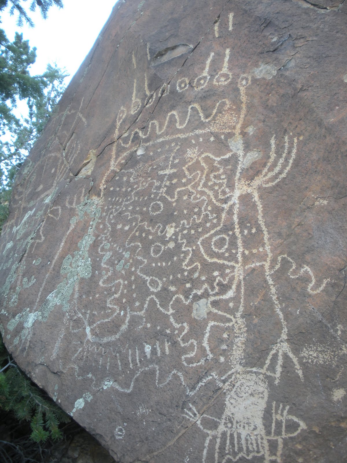
There are a number of Native American petroglyphs just a short walk from where I was camped. I wish I knew more about their origin. I'm not sure anyone knows for sure.


Serenity ...

Wednesday, September 8, 2010

Driving

Let me just state the obvious: I love driving. It's actually one of my favorite pastimes. It's a given that to undertake a trip like the one I'm on here, you'd better be comfortable with long-distance driving.

Some people meditate, in part, to achieve a sense of being in the moment. No past, no future. The eternal now. That's what driving can be. A meditation. Now, I grant you that fighting traffic in large cities is not so special. But moving along an almost empty highway in the wide open west with spectacular things to command your attention, well that's just one of the best ways possible to be "in the now."

I drove from the Los Angeles metro area to the mountains of Wyoming in three days, about a thousand miles. It seemed like one big now moment. On day one, I crossed the barren mountains that separate the LA Basin from the desert interior of California. These mammoth piles of rock and dirt are so different from our green mountains in the east. Their size and barrenness -- no trees to block the view -- seem to emphasize the fact that you are like an ant crawling up and down them.

After crossing the Mojave Desert, I was rolling through Las Vegas around dusk. I could see the glitzy casinos and hotels as I whizzed by, but I didn't even slow down. Cities tend to sap my energy when I'm on a trip like this so I try to avoid them. I cruised on to Mesquite, on the Nevada/Arizona border, where I stopped for the night.

The next day was spent almost entirely travelling through Utah. I'd never driven up the western side of the state on I-15, so this was new territory. More desert dotted with small towns with Biblical-sounding names like Nephi and Levan. Probably place names from the Book of Mormon. When evening rolled around, I was ready to stay somewhere with electricity and water hook ups. I found just the place at Utah Lake State Park on the shores of Utah Lake in Provo. What a beautiful setting.

The next morning I pulled out of Provo and started seeing signs warning that vehicles wider than 12 feet are not permitted in Provo Canyon. I'd never heard of Provo Canyon, but my GPS unit said it was on my route. I pulled over on a downtown street and got out my tape measure to determine the GoJoe's width. Just over ten feet. Whew. The side mirrors stick out beyond that, but there was never a problem. Provo Canyon proved to be beautifully dramatic with steep canyon walls framing the road and the rushing Provo River.

I crossed northeastern Utah and into Wyoming, a region of large ranches with a hint of green vegetation. I stopped for gas in the small ranching town of Afton, with its elkhorn arch stretching across Main Street and storefronts you'd see only in the American West.

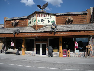


By late evening I had made it to Jackson, a tony enclave of Western chic, and I stopped there for the night.

The next morning I prepared to drive over Togwotee Pass on the Continental Divide at around 10,000 feet. But before I got to the pass, I had to drive through Jackson Hole and was treated to a front row view of the incredible Grand Teton range to my left.


Part way up the mountain road to Togwotee Pass,I found that the asphalt roadway had been peeled away in preparation for repaving. The driving surface was bare dirt - or mud in this case as it had rained during the night.


In places it felt as if I were driving on cake frosting, not a happy feeling in a 14,000 pound RV, especially when coming down the mountain from the summit. There were a few times when I felt GoJoe slip a bit. All this was made a bit less comfortable by the absence of guard rails on the winding mountain road. But I made it over the pass and down the mountain into tiny Dubois, Wyoming, my destination.

Monday, September 6, 2010

In and Out of California


It's not that I don't love California. I do. But it was HOT there. 107 on the day GoJoe went in for repairs. I waited in the reception area like an expectant father. When the service manager finally came out with an affirmative nod followed by a smile, I heaved a sigh of relief. I drove away a happy man, looking for the first exit east.

The night before the repairs, I stayed at a nearby deluxe RV "resort" in Pomona. I enjoyed my one evening of swimming in the pool beneath the swaying palm trees and lolling in the hot tub looking up at the stars.

Before leaving the LA area, I stopped over at the home of friends Judy and Bert for the evening. They graciously allowed me to sleep inside due to the extreme heat. I get a kick out of their five dogs, including the huge Irish wolfhound and tiny chihuahua who are fast friends.


For the next three days I drove fast and furiously north and east. Didn't stop until I was way up in the Rockies. Stay tuned!

Sunday, September 5, 2010

I Get My Kicks ...

So I'm toodling down I-40 in Arizona after a number of days on two-lane roads checking out mind-numbingly beautiful places like Black Canyon and Arches and Goosenecks and Monument Valley. Now it's time to get serious about making it to California in time for my appointment at Lazy Daze RV headquarters. GoJoe needs a little bit of work done there. But I keep seeing all these signs inviting me to get off the interstate and "Travel the Original Route 66."

Now you've got to understand that Route 66 holds a mythical place in my brain as I'm sure it does for countless other baby boomers. After all, we watched "Todd" and "Buzz" on TV each week in the early 60s zipping coolly from one adventure to another along Route 66 in their Corvette. And who doesn't love "I Get My Kicks on Route 66," recorded by Nat King Cole and innumerable others? A road to destiny, it is.

So after the third or fourth invitation to drive the famous Route, I finally succumb. Taking an exit somewhere just over the California line, I'm immediately jouncing on a roadway apparently constructed from giant corduroy turned sideways and coated with jagged concrete. With potholes. When this happens in an RV you find yourself in a world of jangling dishes, tinkling silverware, doors flying open, drawers sliding out, and anything not secured flopping all over. So much for nostalgia.

Back on the interstate I assume I'm done with the storied road. But no. I pull off at Victorville, CA, to get gas. I figure there will be a station within the first block or two. (I "figure" this because I really need gas.) But I go for what seems miles and ... nothing. After a while it becomes absurd. I want to turn around but I keep thinking there's got to be a gas station; I can't give up now. It also enters my mind that this could be happening for a "reason." Finally a station appears on a corner. I fill up and when I pull into the side street to turn around, what do I see before me?


That's right. Fate at its finest.

Inside are all sorts of artifacts to take you back to an earlier time. They have exhibits on old telephone offices, kitchens, clothing, you name it. But I was interested mainly in things that evoked the early efforts of Americans to explore the country by automobile.

Here's the family flivver surrounded by gas station logos and the once-ubiquitous Burma Shave signs - four rhyming signs lined up along the highway extolling the virtues of shaving creme.


And where do you stop when you're on a road trip? A diner, of course.


And finally, the early car camping scene.


All in all, I found the museum much easier to deal with than the actual road.

Friday, September 3, 2010

Monument Valley - Utah, Arizona


This region of spires, buttes and mesas straddles the Utah-Arizona border near Four Corners, where Utah, Arizona, Colorado, and New Mexico meet. I was just driving through as my appointment in Los Angeles to have the RV worked on was fast approaching. I did camp nearby for the evening and was able to see many of the formations from a distance.


Monument Valley has been the setting for countless western movies and TV commercials. On a visit here some years ago, our Navajo guide told of an automobile commercial in which a car was airlifted to the top of one of the chimney-like buttes. Then a young female model was flown up to sit in the car and wave as the scene was filmed from a circling helicopter. Unfortunately, the helicopter later developed mechanical problems and the young woman had to sit in the car on the pinnicle overnight before being rescued the next day. I hope she got paid for the extra hours.


If you saw the movie "Forrest Gump" you may remember Forrest and his followers running up this road near the end of the movie. It was here that Forrest announced that he was finished with running and just stopped. One of the followers said "What do we do now?" Priceless.


This pattern in the mountainside is reminiscent of some patterns in Navajo rugs. Monument Valley and much of the country surrounding it, including Four Corners, is on Navajo land. While driving through the Navajo Nation I enjoyed listening to NPR -- Navajo Public Radio.


P.S. It's Sunday a.m. and I was just reading the blog of a fellow RV traveler. He was writing about how much work went into getting a certain photograph, work that the viewer might never appreciate. I'm sure that's true. But serendipity also plays a role in photography. That was true with the photos at the top of this posting, two of my favorites on the trip so far. The first one, the horses at Monument Valley, happened as I was pulling out of the Goulding's campground. I was heading down the gravel road toward the main highway and admiring the formations in the distance. Suddenly there were these horses standing along the side of the road. I brought the RV to a stop, rolled down the window, and snapped the shot. That's all there was to it. The sunset shot occurred the night before. I was heading over to the laundry room when I saw the great lighting. I ran back to the RV and grabbed my camera. A moment later the whole scene had dissipated. I guess serendipity is another word for dumb luck.

Goosenecks State Park - Mexican Hat, Utah


Be ready to be amazed when you drive up to the edge of an abyss at Goosenecks. What you see below you is the result of 300 million years of the San Juan River eating its way through the desert floor as it winds its way along its serpentine course. You are looking straight down 1,000 feet to where the river flows today. At Goosenecks, the river actually makes two complete loops, but my camera could capture only one of them at a time.


Wednesday, September 1, 2010

Arches National Park - Moab, Utah


Arches and the town of Moab are among my favorite places. This was first prompted by Edward Abbey's seminal book Desert Solitaire, which I read many years ago. Abbey worked for several seasons as a ranger at Arches back during the late 50s, I believe, when it was much less developed than it is today. Although he was from Pennsylvania (very close to Tracey's hometown), he grew to love the west, especially its geography and geology. A reading of Desert Solitaire is an education in the desert west and southwest, its flora and fauna, its geological history, and its possible destruction due to improper use.

I've been to Moab several times before and wish I could have stayed longer this time. But two short forays into Arches were a reminder of the dramatic landscape and formations to be found there. Everyone has probably seen, at least in photographs, Delicate Arch, the natural formation that has become Utah's symbol. (This is a photo of a photo of the arch.) It's a fairly lengthy hike out to Delicate Arch, and I didn't have the time on this visit.

I focused instead on two other notable features of Arches: Park Avenue and Balanced Rock. Park Avenue is so named because you can walk in a valley between two gigantic parallel rock walls whose formations are reminicient of New York skyscrapers.


I got to Park Avenue just after dusk, so my photos are fairly dark. But Park Avenue is a great place to sit and contemplate while the sun goes down and changes the colors on the towering walls. You get to see various hues of dusky reds and golds as the light fades.

Balanced Rock is just a phenomenon. Who knows how long this gargantuan bolder has been perched on its pedestal. This 128-foot formation is the result of millions of years of wind, water, and ice wedge erosion. You can see the various types of rock layers that eroded differently over the eons. Some day the inevitable will happen -- Balanced Rock will topple from its perch.